Sites › South America › Nazca Lines (Peru)
Nazca Lines (Peru)
In Plain English — The 30-Second Takeaway
Huge lines and figures made by clearing stones from the desert floor.
An AI survey found 303 new figures. Small ones sit near trails; giant ones sit near the long lines.
Scholars see the drawings as the work of ancient Nazca-area peoples over many centuries.
A 2024 team thinks small figures were for people on trails and giant ones for group rituals.
Site Story & Overview
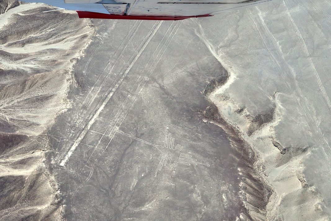
The Nazca Lines are huge drawings on the desert floor of southern Peru. People made them by clearing away dark surface stones to show the lighter ground below.
▸ Read Full Archaeological & Engineering Context
They include straight lines, trapezoids and figures of animals and people. A 2024 study used AI to find many new small figures and compared where the two kinds of figures sit.
✓ What Is Physically Measured on Site
Dated samples, laser scans, stone weights, and dug finds kept separate from opinion.
- AI found 303 new figures: A 2024 study ran an AI system over the whole Nazca area. With six months of field checks, it found 303 new figure drawings. Before that, about 430 were known after nearly a century of searching. [1]
- Small figures near trails: The small 'relief-type' figures mostly show people or things people changed, such as tame animals and cut-off heads (81.6%). They lie on average 43 m from old foot trails. [1]
- Giant figures near the lines: The giant 'line-type' figures mostly show wild animals (64%). They lie on average 34 m from the network of long lines and trapezoids. [1]
- A date from near Palpa: Rink and Bartoll (2005) give a luminescence date of AD 400–650 for geometric lines on mesas near Palpa, not the Nazca plain. [2]
- A huge area: UNESCO says the protected area covers about 75,358 hectares of desert plain. [3]
🏛️ Mainstream Archaeological View
- Accepted timeline: Ground drawings made by removing surface stones on the desert of southern Peru. UNESCO dates the tradition from about the 8th century BC to the 8th century AD.
- Stone & hardness: Not reported in the sources on this page. Mohs hardness: not reported in our sources.
- Quarry distance & alignment: Stone source not reported in the sources on this page. Orientation: Not reported in the sources on this page.
🧭 Leading Edge Proposal & Open Questions
- Interpretation: Sakai and colleagues (2024): Who used them, and how? The authors think the small figures were made and seen by single people or small groups walking the trails. They think the giant figures were made and used by whole groups for ritual. That is their reading of where the figures sit. [1]
Primary Academic Sources
▸ View All Cited Primary Sources & DOIs (3 papers)
- Sakai, M., Sakurai, A., Lu, S., Olano, J., Albrecht, C. M., Hamann, H. F. & others (2024). AI-accelerated Nazca survey nearly doubles the number of known figurative geoglyphs and sheds light on their purpose. PNAS 121(40): e2407652121. doi:10.1073/pnas.2407652121 data
- Rink, W. J. & Bartoll, J. (2005). Dating the geometric Nasca lines in the Peruvian desert. Antiquity 79(304): 390–401. doi:10.1017/s0003598x00114176 data
- UNESCO World Heritage Centre. Lines and Geoglyphs of Nasca and Pampas de Jumana (list no. 700), accessed 2 November 2026 https://whc.unesco.org/en/list/700 background
Dates and stone checks are summed up in plain English from the papers above. Measured facts stay separate from opinion. Methodology.