Sites › North America › Pinson Mounds (Tennessee, USA)
Pinson Mounds (Tennessee, USA)




In Plain English — The 30-Second Takeaway
A large group of Native American earthen mounds in West Tennessee.
Sauls Mound is about 22 m (72 ft) tall. A 2004 study re-figured 39 radiocarbon dates from the site.
It was built and used in the Middle Woodland period, about 1 to 500 CE, mainly for rituals and gatherings.
A 1922 report described a walled city with 35 mounds. Later checks found many of those features are natural.
Site Story & Overview
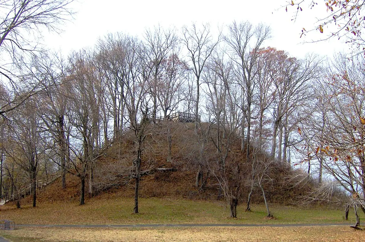
Pinson Mounds is a large group of earthen mounds in West Tennessee, built by Native American peoples about 2,000 years ago. Its largest mound, Sauls Mound, is about 22 m (72 ft) tall.
▸ Read Full Archaeological & Engineering Context
Archaeologists see the site as a place for rituals and gatherings, not a town. Many features drawn on a 1922 map have not held up to newer checks. Today it is a state archaeological park.
✓ What Is Physically Measured on Site
Dated samples, laser scans, stone weights, and dug finds kept separate from opinion.
- Site size: The mounds are spread over about 160 ha (about 400 acres). The site sits on a bluff above the South Fork of the Forked Deer River. [1][2]
- How many mounds: Early reports listed 30 or more mounds and miles of walls. Modern work has confirmed 13 mounds and about 3,500 feet of a curved earthen wall. [1][2]
- Sauls Mound: The largest mound is about 22 m (72 ft) tall and about 100 m across. It holds about 60,500 m³ of soil. [1][2][5]
- How tall compared with others: Tennessee's state archaeologists rank Sauls Mound as the tallest mound of the Middle Woodland period in the U.S. A 2020 study calls it the second-tallest earthen monument built in North America. [1][6]
- Five flat-topped mounds: The site has five large platform mounds. They range from about 2.5 to 22 m tall. [3]
- 39 radiocarbon dates: A 2004 study re-figured (calibrated) all 39 radiocarbon dates from the site. The authors say Pinson may have more dates than any other Middle Woodland site in North America. They found that mound building went on at least a century longer than once thought. [3]
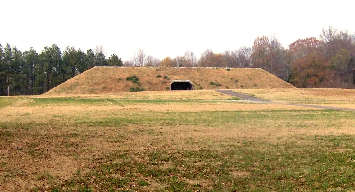
- Ozier Mound: The second-largest mound is about 10 m tall, with a ramp on its northeast side. It was built in at least six stages. The flat top of each stage was covered with pale yellow sand. [4][3][1]
- Why Ozier matters: Many archaeologists once thought the big flat-topped mounds here came from the later Mississippian period. Dates from Ozier Mound gave the first clear proof that Middle Woodland people built mounds like these. [4][3]
- Ozier dates: Charcoal from features on its top layer, including fire pits, was radiocarbon dated. A 2004 recalculation of four of these dates gave a range of about 128 to 383 CE. The authors lean toward the older end. [3]
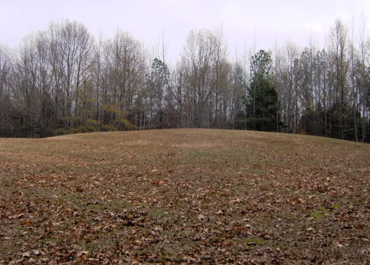
- Twin Mounds: Two burial mounds joined side by side lie about 200 m to the south of Ozier Mound. Each is about 7 m high and 25 m wide. Under the northern one, diggers found tombs covered with logs or fabric. One tomb held at least eight young women and many shell beads. [3][1]
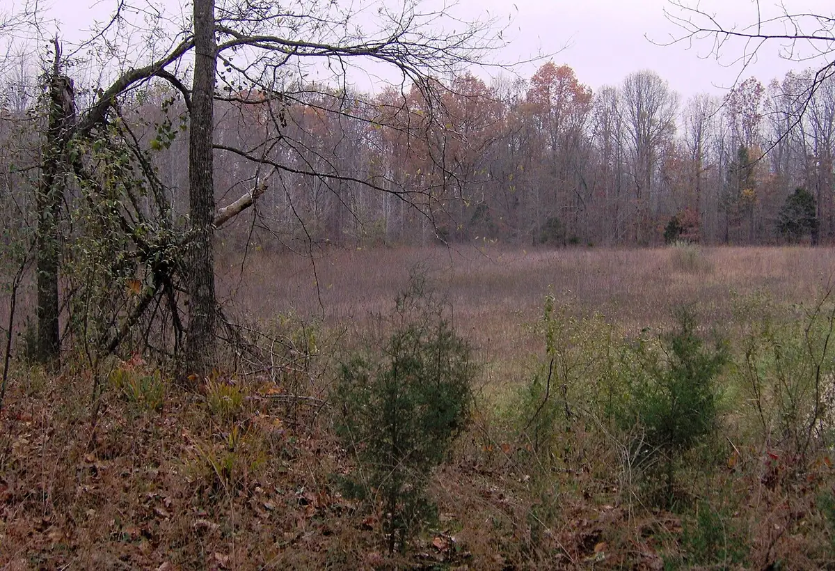
- Eastern Citadel: A curved earthen wall about 360 m across and about 2 m tall surrounds about 6.7 ha. Part of it follows a true circle. Erosion and plowing have worn much of it down. [2][1][5]
- Visitors from far away: Pottery found here came from places such as the Tennessee River valley, southern Georgia and the Hopewell areas of Ohio and Illinois. [1]
- No village found: No clear sign of Middle Woodland homes has been found. State archaeologists say the evidence points to short stays for rituals. [1][2]
- Testing an old map: A magnetometer survey covered about 3.5 ha where the 1922 map showed an inner wall. It found no sign of that wall, but it did find signs of much past human activity. The authors note that one method alone cannot fully rule the wall out. [5]
- LiDAR here: State archaeologists say new LiDAR (laser mapping from the air) and ground surveys are helping them re-check the shape of the site. [1]
- LiDAR at the nearby Johnston Site: The park also manages the Johnston Site, about 6 km to the northwest. A 2020 study there used state LiDAR from 2011–2012 and magnetic surveys. It found a buried ditched enclosure under one mound, traces of a mound that no longer shows on the surface, and a ring-shaped feature like the Duck's Nest at Pinson. [6]
- Status today: Pinson Mounds became a National Historic Landmark in 1964. It opened to the public as a state archaeological park in 1981. The park has a museum and trails. [1][8][7]
Open questions
These points are not settled in the sources we opened.
- Open question How many mounds? Counts differ by source: at least 12 (1988 paper), 13 confirmed (state archaeologists) and at least 17 (state parks website). [2][1][7]
- Open question Sauls Mound's own date: The 1988 paper reported no radiocarbon dates yet from the platform mounds other than Mounds 5 and 10, so none from Sauls Mound. Its Middle Woodland age rested on the dated mounds and the site's artifacts. We did not find a later direct date for it in the sources we opened. [2]
- Open question Eastern Citadel's age: The 2004 study said dates are still needed from the Eastern Citadel and its Mounds 29 and 30. [3]
- Open question What the flat tops were for: Digs on the top of Ozier Mound found no building. The 1988 paper called the use of these flat-topped mounds unclear. [2][3]
🏛️ Conventional Archaeological View
- Conventional dating: Middle Woodland period. Built and used about 1–500 CE (Mainfort 1988). Tennessee's state archaeologists put the main building and use at about 100–350 CE.
- Stone & hardness: Earthen mounds of basket-loaded soil and sand, no cut stone (Mainfort 1988; Mainfort and Walling 1992). Mohs hardness: not reported in our sources.
- Quarry distance & alignment: Stone source none (earthen site). Soil: a likely source about 200 m south of Sauls Mound, not firmly identified (Mainfort 2013). Orientation: no tested alignment in our sources; a 2011 study says the 1922 map is too distorted for alignment work.
🧭 Leading Edge Proposal & Open Questions
- Historical claim: William Myer (1922): A walled city? Myer wrote of "a great ancient walled city" with 35 mounds and outer walls fully six miles long. Later digs and maps found that many of these features are natural rises in the land. [2][1]
- Critique: Mainfort, Kwas and Mickelson (2011): An old map put to the test: The team checked the 1917 survey behind Myer's map against old photos and newer maps. They conclude the map is too distorted to use for sky-alignment studies. [5]
- Park description: Tennessee State Parks: Sky watching? The park website says the site was used for gatherings, rituals and "astronomical observations." In the sources we opened, we found no published alignment test for Pinson. [7][5]
- Debate status: Any pushback on the date? No published challenge to the Middle Woodland date was found in the sources we opened. [2][3]
Primary Academic Sources
▸ View All Cited Primary Sources & DOIs (8 papers)
- Tennessee Division of Archaeology (TDEC). Pinson Mounds State Archaeological Park, accessed 9 November 2026 https://www.tn.gov/environment/program-areas/archaeology/arch-parks/p… background
- Mainfort, R. C., Jr. (1988). Middle Woodland ceremonialism at Pinson Mounds, Tennessee. American Antiquity 53(1): 158–173. doi:10.2307/281161 data
- Mainfort, R. C., Jr. & McNutt, C. H. (2004). Calibrated radiocarbon chronology for Pinson Mounds and Middle Woodland in the Midsouth. Southeastern Archaeology 23(1): 12–24 (copy hosted by the Tennessee Division of Archaeology). https://www.tn.gov/content/dam/tn/environment/archaeology/documents/s… data
- Mainfort, R. C., Jr. & Walling, R. (1992). 1989 excavations at Pinson Mounds: Ozier Mound. Midcontinental Journal of Archaeology 17(1): 112–136 (copy hosted by the Tennessee Division of Archaeology). https://www.tn.gov/content/dam/tn/environment/archaeology/documents/s… data
- Mainfort, R. C., Jr., with Kwas, M. L., McNutt, C. H., Mickelson, A. M. & Thunen, R. (2013). Pinson Mounds: Middle Woodland Ceremonialism in the Midsouth. University of Arkansas Press. Chapter 3 reprints Mainfort, Kwas & Mickelson (2011), Southeastern Archaeology 30(1): 148–165, doi:10.1179/sea.2011.30.1.011 (copy hosted by the Tennessee Division of Archaeology). https://www.tn.gov/content/dam/tn/environment/archaeology/documents/s… data
- Henry, E. R., Wright, A. P., Sherwood, S. C., Carmody, S. B., Barrier, C. R. & Van de Ven, C. (2020). Beyond Never-Never Land: integrating LiDAR and geophysical surveys at the Johnston Site, Pinson Mounds State Archaeological Park, Tennessee, USA. Remote Sensing 12(15): 2364. doi:10.3390/rs12152364 data
- Tennessee State Parks. Pinson Mounds Highlights (park page), accessed 9 November 2026 https://tnstateparks.com/parks/pinson-mounds/highlights background
- National Park Service. National Historic Landmarks: list by state (Tennessee: Pinson Mounds, designated 29 January 1964), accessed 9 November 2026 https://www.nps.gov/subjects/nationalhistoriclandmarks/list-of-nhls-b… background
Dates and stone checks are summed up in plain English from the papers above. Measured facts stay separate from opinion. Methodology.