△ TruthInStone

Sites › North America › Poverty Point

Poverty Point

Poverty Point
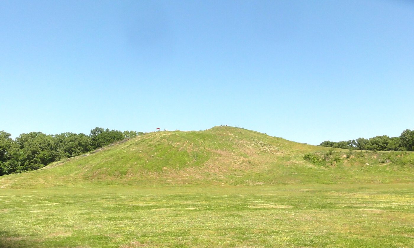
Image: Bart Everson, Wikimedia Commons, CC BY 2.0. Resized; not otherwise altered. All credits.
📍 Where It Is West Carroll Parish, northeastern Louisiana, USA 32.6356°, -91.4083°
🏛️ Mainstream Date c. 1700–1100 BCE (Late Archaic hunter-gatherer-fishers) Excavated baseline
🧭 Leading Edge / Open Angle Proves non-farming hunter-gatherers built massive geometry Debated or newly revised
🪨 Heaviest Stone & Quarry 750,000 m³ of earthworks · Copper & stone imported up to 1,300 km 0.0× the 40-ton test limit · Compare all 64 sites →
30-SECOND TAKEAWAY

In Plain English — The 30-Second Takeaway

What It Is:

Poverty Point in Louisiana is a giant complex of six curved earthen rings. Also, a 22-meter-tall mound built over 3,000 years ago.

What Everyone Agrees On (Measured Facts):

Builders moved 750,000 cubic meters of earth in woven baskets. Raising Mound A in under 90 days. Also, imported copper and flint from up to 1,300 km away.

🏛️ Mainstream Archaeology View:

Digs prove the builders were hunter-gatherers living on fish, deer. Wild nuts who never planted corn or farmed.

🧭 Leading Edge View:

Like Göbekli Tepe, Poverty Point shattered the old rule that only farming states with kings and taxes could build giant sites.

Site Story & Overview

Six concentric earthen ridges and several large mounds built by people who did not farm. The site challenges the older assumption that monuments on this scale needed agriculture and a ranked society.

✓ What Is Physically Measured on Site

Dated samples, laser scans, stone weights, and dug finds kept separate from opinion.

How carbon dates work, and their limits: How we date sites.

🏛️ Mainstream Archaeological View

  • Accepted timeline: Late Archaic, about 1700–1100 BCE, built by hunter-gatherer-fishers.
  • Stone & hardness: Loess silt/clay earthworks + imported copper/chert/hematite/soapstone — Mohs hardness 1.5 (Loess earthworks; imported quartz/chert Mohs 7) (on the 1–10 Mohs scale where a steel knife is ~5.5 and diamond is 10).
  • Quarry distance & alignment: Stone source 0.5 km for earth; lithic raw materials transported 500–1,300 km by river. Orientation: Concentric C-ridges open east toward Bayou Maçon; solstice sightlines proposed.

🧭 Leading Edge Proposal & Open Questions

  • Timeline consensus: Like Göbekli Tepe, Poverty Point shattered the old rule that only farming states with kings and taxes could build giant sites.
  • Engineering comparison: Heaviest unit is 238,000 m³ in Mound A (~750,000 m³ total site earthworks; lithics imported up to 1,300 km) (0.5 km for earth; lithic raw materials transported 500–1,300 km by river). See how it compares in our 64-Site Scale-Gap Explorer.

Visiting & base stays: Poverty Point World Heritage Site (Pioneer / Monroe, Louisiana & Vicksburg, MS base, USA)

FTC affiliate disclosure: Tour links go to GetYourGuide and Viator. Hotel links use Stay22 (aid=solarevidence) for Booking.com and Expedia. If you book a trip, we may earn a small fee at no extra cost to you. All partner links use rel="sponsored nofollow noopener". Check travel alerts before you go. Partner fees never change our ratings. All 64 site field visits · Affiliate disclosure.

📚 Further Reading: Both Sides of the Argument

Top books from both sides of the debate on this topic. Browse all 34 books on Books & Further Reading or visit our Search for the Truth Bookshop.org storefront.

Mainstream Baseline 2021 ★ 4.5/5

The Dawn of Everything: A New History of Humanity

David Graeber & David Wengrow

Examines how hunter-gatherers built giant stone sites like Göbekli Tepe and Poverty Point without kings or farming.

▸ Why this book matters to both sides

An culture scholar and an archaeologist examine Göbekli Tepe, Karahan Tepe, Poverty Point, Watson Brake, and Teotihuacan. It challenges the textbook step-by-step ladder from small hunter-gatherer bands to states.

Role in the debate: Shows how mainstream archaeology accounts for giant buildings built by hunter-gatherers (Göbekli Tepe, Poverty Point) without invoking a single global parent culture. (ISBN 9781250858801)

Mainstream Baseline 2005 ★ 4.6/5

1491: New Revelations of the Americas Before Columbus (2nd ed.)

Charles C. Mann

Shows how new digs and laser maps proved the ancient Americas held big cities, roads, and farms long before Columbus.

▸ Why this book matters to both sides

Surveys the archaeological, botanical, and demographic discoveries showing that the pre-Columbian Americas—from Caral-Supe and the Amazon basin to Cahokia—were older, more populous, and more engineered than once taught.

Role in the debate: Documents how mainstream field evidence overturned the 20th-century 'pristine wilderness' model in the Amazon and pushed giant buildings in Peru back to the third millennium BCE. (ISBN 9781400032051)

Leading Edge 2019 ★ 4.7/5

America Before: The Key to Earth's Lost Civilization

Graham Hancock

Explores Amazon earthworks, Serpent Mound, ancient DNA, and early American sites to argue for an Ice Age culture in the Americas.

▸ Why this book matters to both sides

Tests pre-Clovis archaeological sites, Ancient North Eurasian DNA signals, Amazonian earthworks, Serpent Mound, and Poverty Point. It argues the Americas were central to an Ice Age cultural network.

Role in the debate: Contrasts directly with Charles Mann's *1491* and mainstream Americanist archaeology on early peopling, Amazon geoglyphs, and North American earthen mounds. (ISBN 9781250756954)

Leading Edge 2006 ★ 4.5/5

The Cycle of Cosmic Catastrophes: How a Stone-Age Comet Changed the Course of World Culture

Richard Firestone, Allen West & Simon Warwick-Smith

The founding book on the Younger Dryas comet impact idea, covering melted microbeads, black mats, and mammoth die-offs.

▸ Why this book matters to both sides

The first book-length presentation of the Younger Dryas impact idea by members of the team that published the 2007 PNAS paper. It details magnetic melted beads, black mats, and Clovis-era giant-animal die-offs.

Role in the debate: Gives the founding supporters' case for the ~12,800 BP Younger Dryas impact boundary, which can be read alongside subsequent separate replications and published critiques. (ISBN 9781591430612)

FTC affiliate disclosure: Book links go to Bookshop.org (ID 130218, Search for the Truth). Each sale helps local bookstores and pays us a 10% fee at no extra cost to you. All partner links use rel="sponsored nofollow noopener". Fees never change our verdicts. Affiliate disclosure.

Primary Academic Sources

▸ View All Cited Primary Sources & DOIs (3 papers)
  1. Ortmann, A. L. & Kidder, T. R. (2013). Building Mound A at Poverty Point, Louisiana: monumental public architecture, ritual practice, and implications for hunter-gatherer complexity. Geoarchaeology 28. doi:10.1002/gea.21430 data
  2. Kidder, T. R. et al. (2021). Multi-method geoarchaeological analyses demonstrates exceptionally rapid construction of Ridge West 3 at Poverty Point. Southeastern Archaeology 40. doi:10.1080/0734578x.2021.1958445 data
  3. UNESCO World Heritage Centre: Monumental Earthworks of Poverty Point (inscribed 2014). https://whc.unesco.org/en/list/1435/ background

Dates and stone checks are summed up in plain English from the papers above. Measured facts stay separate from opinion. Methodology.